Throughout history, humanity has driven the exploration of distant territories, revealing ancestral landscapes and cultures. Although much of the planet has already been mapped, every year thousands of travelers seek new routes that connect them with nature and with themselves.
Below, we share a comparative guide to outstanding trekking routes, including the Inca Trail to Machu Picchu, analyzing their attractions, difficulty level, climate, and overall experience.
Table of Contents
Location:
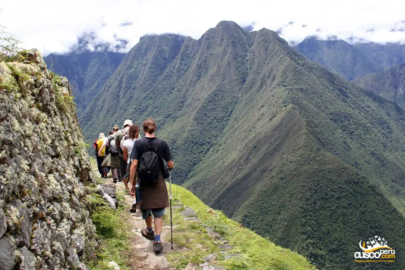
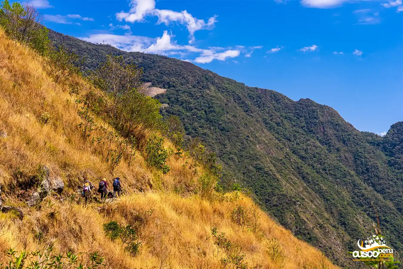
The Inca Trail to Machu Picchu is located in the Cusco region, in southeastern Peru, in the heart of the Andes mountain range. This route is part of the extensive Inca road system known as the Qhapaq Ñan, a communication network that covers more than 30,000 kilometers.
The hike begins at kilometer 82 of the railway line between Ollantaytambo and Aguas Calientes, and ends at the impressive Inca citadel of Machu Picchu after four days of trekking along this Inca route.
Note: during the month of February, the Inca Trail remains closed for trail maintenance and conservation.
Attractions:
Machu Picchu, located in the Historic Sanctuary of the same name, is a natural reserve of more than 35,000 hectares. This environment is home to great biodiversity, including species such as orchids, birds, spectacled bears, and Andean foxes.
Throughout the hike, numerous Inca archaeological remains can also be discovered: watchtowers, villages, agricultural terraces, water channels, stairways, and stone-paved paths.
Difficulty Level:
It is considered a hike of intermediate difficulty. The greatest physical challenge comes when crossing high mountain passes, especially Abra Warmiwañuska or the "Dead Woman’s Pass," located at more than 4,200 m.a.s.l. However, many travelers can complete this route with proper acclimatization and physical preparation.
Climate:
During the day, the weather is usually mild and mostly sunny. However, from November to March, the rainy season takes place, so it is likely to experience one or two days of rain along the route, even during the camping nights.
Location:
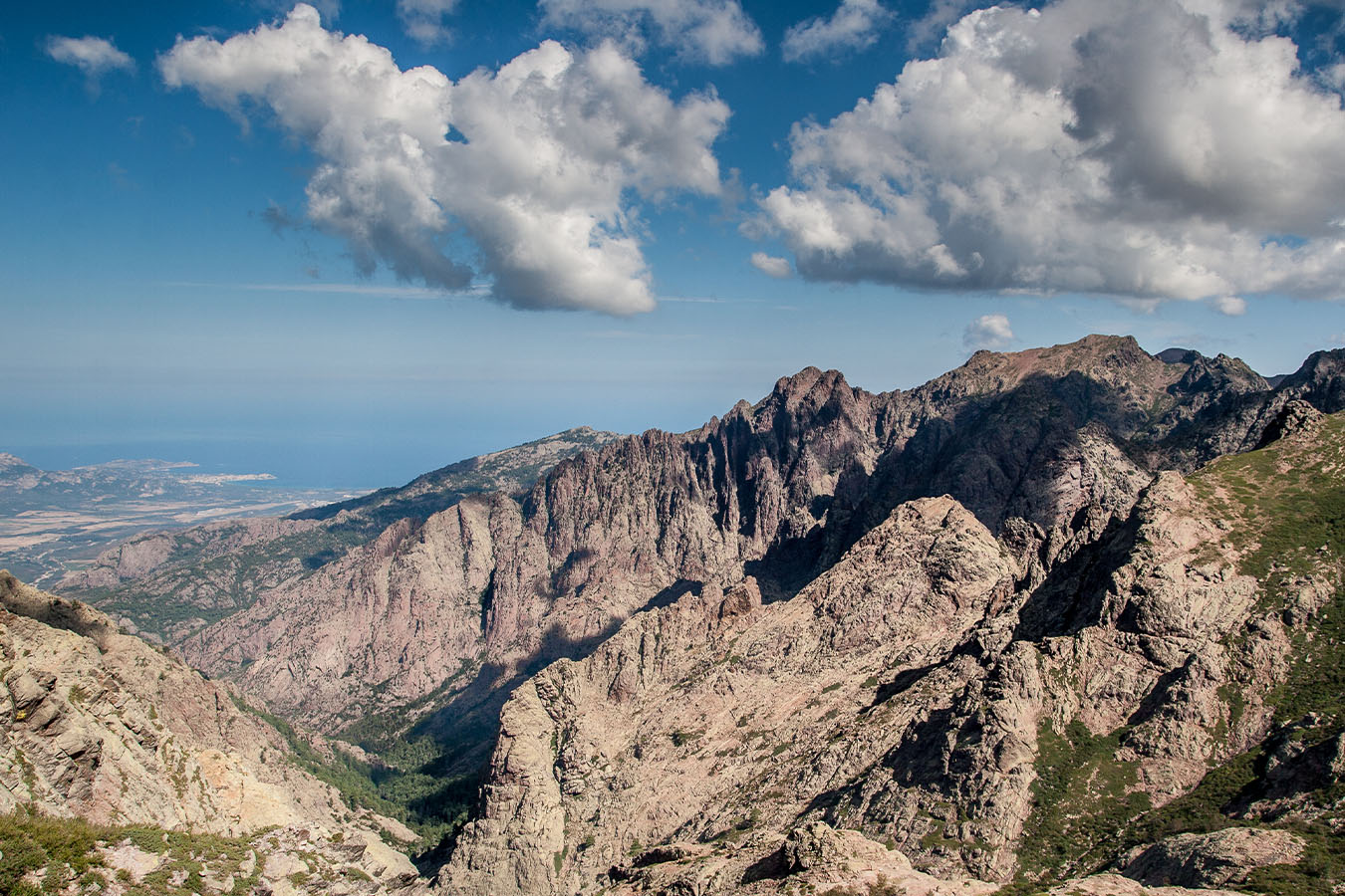
The GR20 is a classic 16-day crossing that runs across the island of Corsica, in France, from north to south. This French island, located in the Mediterranean Sea, offers a route divided into 16 stages, although some hikers choose to complete it in fewer days, depending on their goals, experience, and pace.
Attractions:
Mountains, steep valleys, crystal-clear lakes, and panoramic views characterize this route.
Difficulty level:
High. Its rugged terrain and steep climbs make it a route for experienced hikers.
Climate:
Hot and humid on the coast, colder and rainier in the mountainous interior. Even in summer, there may be snow on the peaks.
Location:
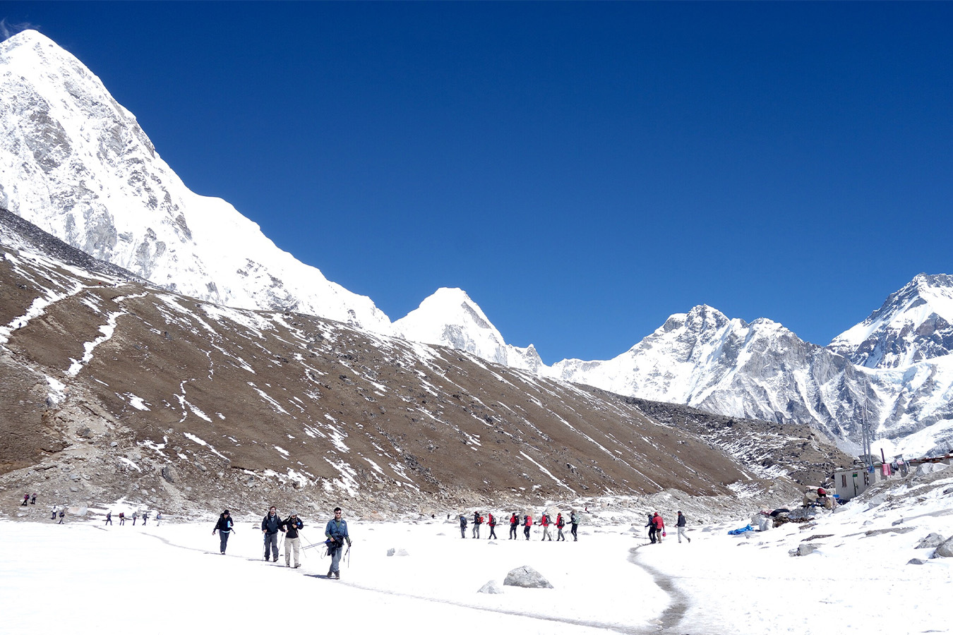
Located on the border between China and Nepal, Mount Everest offers two access points to its base camp: the south, from Lukla (Nepal), and the north, from Tibet (China). The most popular hike is to the south base camp, at 5,364 m.a.s.l.
Attractions:
Sagarmatha National Park, in Nepal, is home to some of the highest mountains in the world, including Mount Everest.
Difficulty Level:
Intermediate. Hikers walk 4 to 8 hours per day for approximately 13 days, plus 1 or 2 days of acclimatization. Altitude sickness is the greatest challenge.
Climate:
Very changeable. The best months are from March to May and from September to November, avoiding the rainy season.
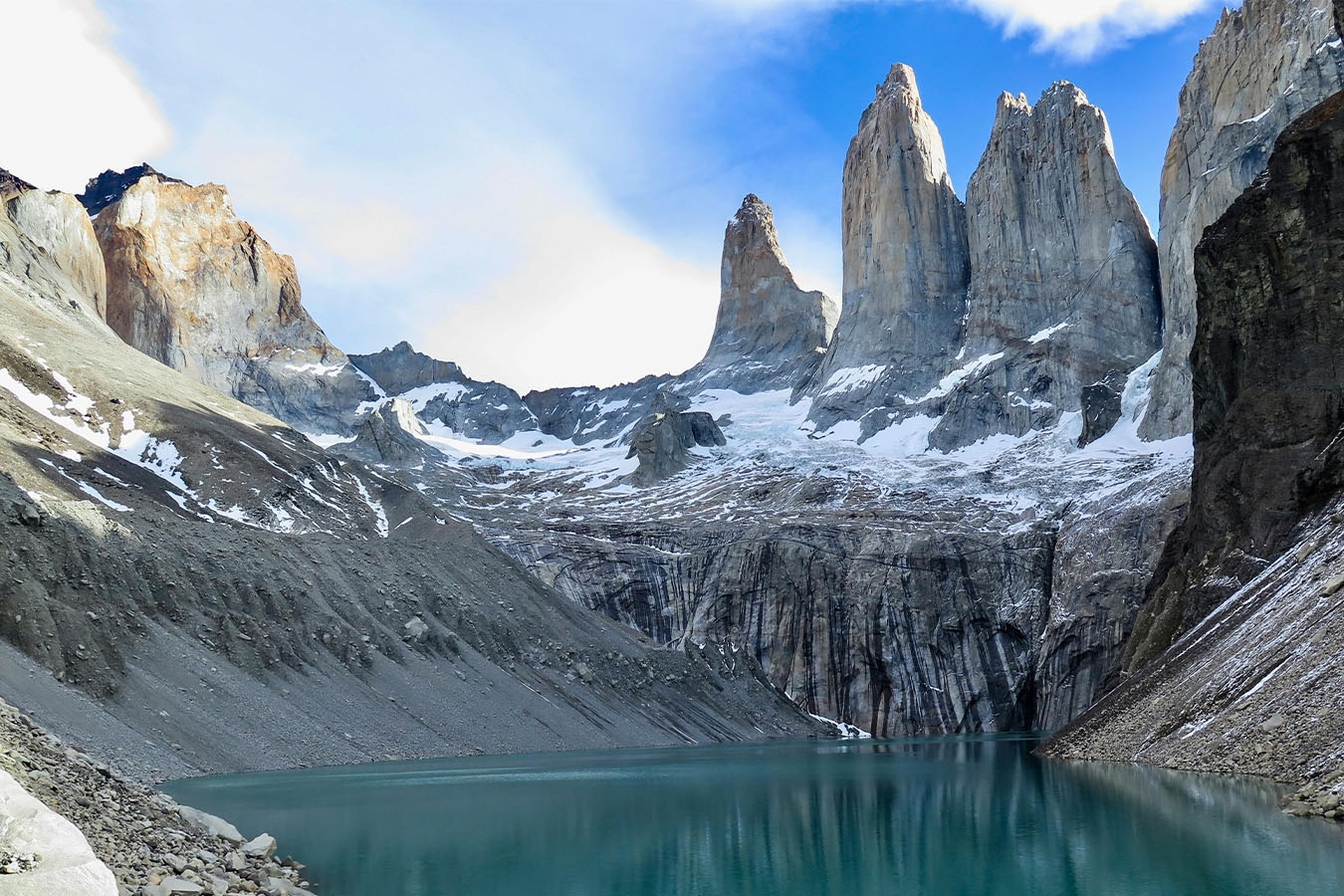
Location:
In the Magallanes and Chilean Antarctica region, in southern Chile, lies Torres del Paine National Park, in the heart of Patagonia. It covers an area of 181,414 hectares.
Attractions:
Glaciers such as Grey, turquoise lakes, colorful valleys, and the iconic Paine Massif, with millenary granite formations.
Difficulty Level:
Its difficulty is moderate to high. You should keep in mind that it features several steep ascents and descents, with a cumulative elevation gain of approximately 3,000 meters.
Climate:
From December to March, it is high season with good weather; in winter, by contrast, there is snow and extreme cold.
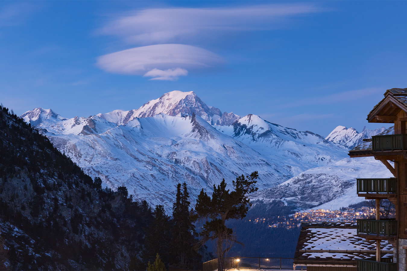
Location:
Mont Blanc (Monte Bianco) is located in the Alps, on the border between France, Italy, and Switzerland. Its summit stands between 4,805 and 4,810 m.a.s.l., although its border delimitation is disputed.
Attractions:
Crossing the European Alps offers views of alpine valleys, picturesque villages, and the gastronomy of three countries.
Difficulty Level:
Intermediate, with tourist infrastructure support that allows hikers to lighten the weight of their backpacks and rest in comfortable refuges.
Climate:
From July to September is the best time. Out of season, the weather is cold and many routes and accommodations remain closed.

Happy passengers