
The Nazca Lines are one of Peru's most important cultural heritages and one of the world's most unique archaeological landscapes. Declared a UNESCO World Heritage Site in 1994, these mysterious giant figures drawn in the desert continue to fascinate archaeologists, scientists, and travelers from around the world.

The Nazca Lines, also known in scientific terms as "geoglyphs," are one of the most important legacies of Peru's ancient pre-Inca cultures. They are located in the provinces of Nazca and Palpa, in the Ica region, across desert plains such as Jumana and San José. In this vast stretch of coastal desert, you can see geometric figures, animals, plants, objects, human beings, and possible representations of deities.
Regarding the origin and meaning of these lines, archaeologists have proposed various theories, although there are also popular interpretations that are less substantiated. Some interpret them as an enormous astronomical calendar, while others see them as a place of water worship built by the Paracas and Nazca cultures.
The first written record of the lines was made by Pedro Cieza de León, a Spanish chronicler of the conquest, in 1547. However, when seeing them from the ground, Cieza believed they were simply "signs along the road" or paths. Almost 400 years later, in 1927, Peruvian archaeologist Toribio Mejía Xesspe rediscovered the lines during an expedition. Like Cieza de León, when he arrived at the area where the Nazca Lines are located, he believed they were merely ceremonial paths or "ceques" (sacred Inca lines).
In 1939, the true extent of the lines was revealed. American anthropologist Paul Kosok, while flying over the area in a small plane in search of ancient irrigation systems, noticed that the lines formed enormous, perfectly designed figures. This marked the beginning of worldwide scientific interest in this archaeological enigma. Kosok called the Nazca Lines "the world's largest astronomy book" and was the first to propose that they had an astronomical function.
Beginning in the 1940s, Maria Reiche, a German mathematician and archaeologist, continued and expanded these studies. She dedicated more than 50 years of her life to measuring, cleaning, researching, and protecting the lines. Today, Maria Reiche is remembered as "the Lady of the Lines". Research continues using modern technology such as drones, artificial intelligence, and satellite photography, leading to the discovery of new figures.
Although there is no single accepted explanation, researchers suggest that the lines may have had ritual or astronomical functions or may have been related to water worship among the Paracas and Nazca cultures.
The Nazca Lines are located in the Pampas de Jumana, in the Ica region of southern Peru, near the city of Nazca. Nazca is a city located 500 km south of Lima, at an altitude of approximately 600 meters. The name "Nazca" comes from the ancient and enigmatic pre-Inca culture of the same name.
Main Geoglyphs You Can See
The Astronaut is an approximately 30-meter anthropomorphic figure located on a hillside that has generated many popular interpretations.
The Hummingbird, approximately 96 meters long, is one of the most emblematic figures of the Nazca Lines.
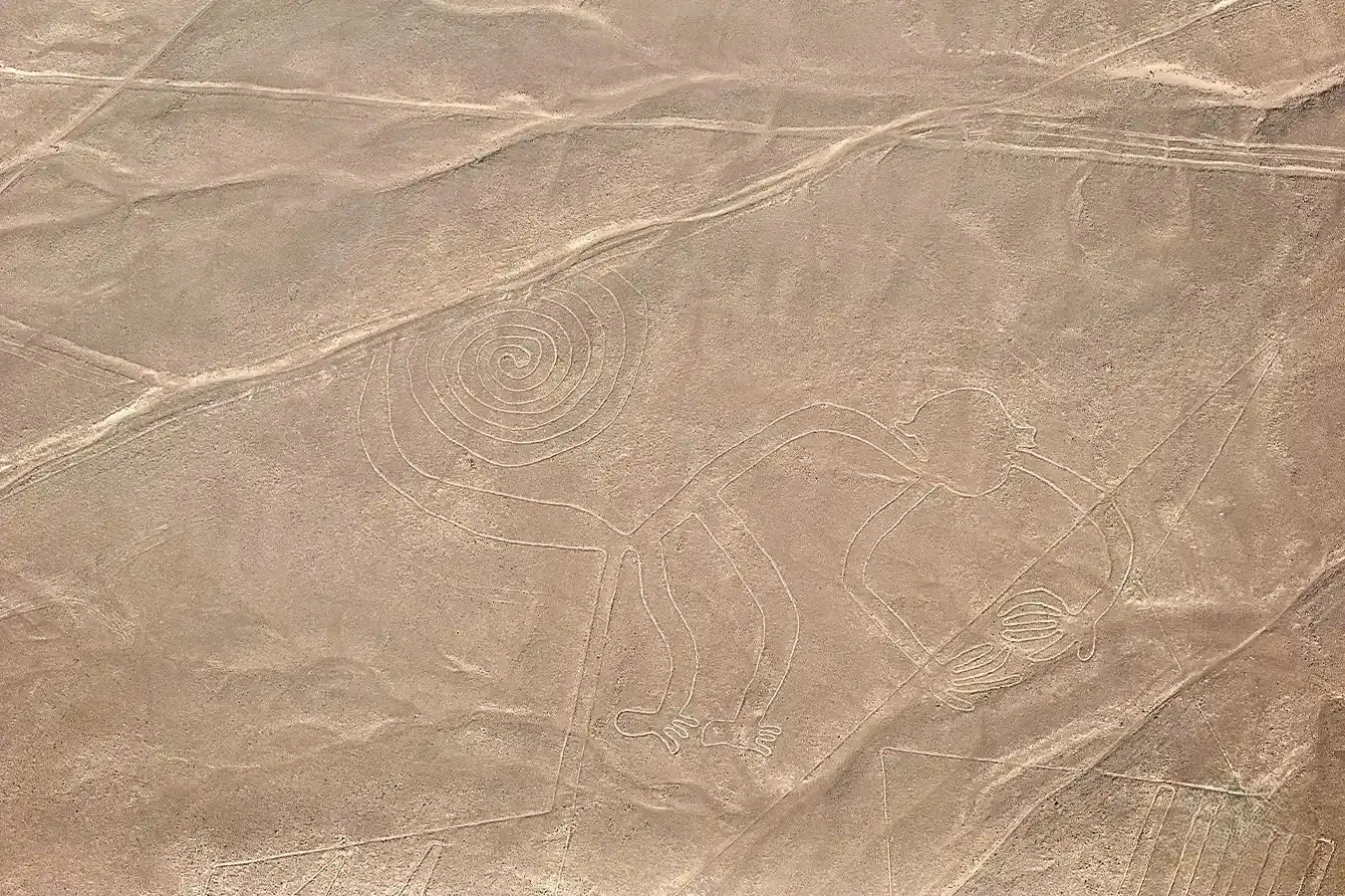
The Monkey measures approximately 110 meters and stands out for its spiral-shaped tail.
The Spider measures about 46 meters and attracts attention because of the details of its legs.

The Condor, with an approximate wingspan of 135 meters, represents the sacred Andean bird.
The overflight of the Nazca Lines by small aircraft includes:
Duration: the flight usually lasts between 30 and 35 minutes.
Visible figures: you can see between 12 and 14 main figures (Hummingbird, Monkey, Spider, Condor, Astronaut, etc.).
Aircraft: generally small aircraft, such as Cessna 206 or similar models, depending on the operating company.
Tilt: the aircraft usually tilts to both sides so that all passengers can observe the figures.
Best time: flying early in the morning is recommended, when there is usually less turbulence and better visibility.
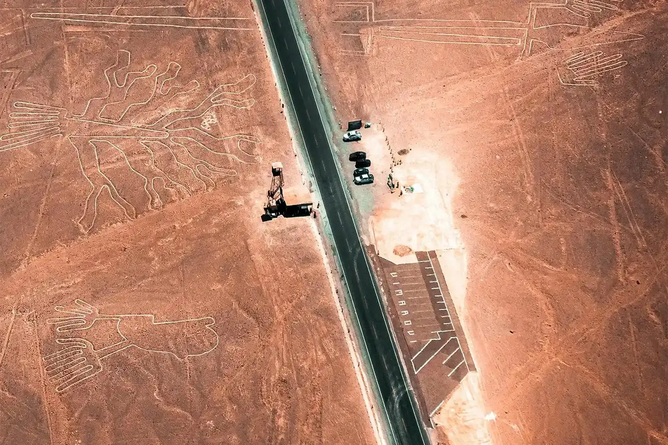
There are observation towers along the Pan-American Highway South from which some figures can be seen, such as the Tree, the Hands, and part of the Lizard. The view is limited, but it can be an alternative for those who do not wish to take the overflight.
Currently, platforms such as Google Earth allow you to explore the lines in high resolution from home, although the experience does not replace an in-person visit or an overflight.

Overflights of the Nazca Lines usually operate from the early morning until the afternoon, depending on weather conditions and each operator's schedule. The earliest times are generally recommended because they normally offer better visibility and a lower possibility of turbulence.
The Nazca Lines can be visited year-round, but consider these two seasons:
Dry season (May-October): you can expect clearer skies, better visibility, and less turbulence.
Season with greater rainfall or cloud cover (December-March): warmer temperatures, occasional cloud cover, and fewer tourists.
Best months: June to August, when skies are usually clearer and conditions are favorable for the overflight.
What to Bring:
Restrictions and Regulations:
Safety:
The classic flight lasts approximately 30 minutes and allows you to see the main figures in the desert. Some operators offer extended flights that include other nearby archaeological areas.
The Nazca Lines have remained intact for thousands of years due to the climatic and geological conditions, as this is one of the driest places in the world.
Yes. It is a World Heritage Site and offers the opportunity to experience a cultural landscape with more than 1,500 years of history.
Yes, but only some of the figures. From the land-based observation towers, you can see the Tree, the Hands, and part of the Lizard, although the view is more limited than from the overflight.
The safety of the overflight depends on choosing an authorized company, proper aircraft maintenance, and the weather conditions on the day. Therefore, booking with certified operators is recommended.
It depends on each traveler's personal circumstances and the operator's recommendations. It is advisable to check in advance whether there are any special conditions.

Happy passengers