

These archaeological groups are located beyond the Q’ente sector, along the Inca Trail route to Machu Picchu. Travelers can visit them starting on the second day of the Classic Inca Trail trek. These sites feature agricultural terraces, enclosures, ceremonial shrines, aqueducts, and other remains associated with the Inca road network.
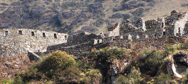
They are located within the Urubamba River basin, along the Inca Trail leading to Machu Picchu.
This complex is located after crossing the Kusichaka Bridge, continuing along the Inca Trail toward the higher sections of the route. Visitors can observe remains of ancient enclosures, small groups of agricultural terraces, and traces of an Inca canal.
Wayllabamba is a rural community located along the Inca Trail. Patawasi corresponds to an upper area associated with this sector. Here, visitors can see walls, unfinished terraces, rustic tombs, and fragments of ancient aqueducts.
Paucarcancha likely served as a tambo (resting station) or control point along the route. From Wayllabamba, visitors follow the stream upstream until reaching the confluence of two waterways that form the Wayllabamba River.
Further uphill lies Inkarakay, an archaeological group with a unique layout featuring circular structures and walls adapted to the terrain. From this point, there are views of the ravine, as well as rectangular courtyards and ancient enclosures.
Ascending from Inkarakay through the Qesqamayu stream valley, which joins another watercourse to form the Wayllabamba River, visitors reach Inkasamana after approximately 800 meters. This is a small archaeological site with remains of agricultural terraces.
Farther ahead, about 5 km away, there is another complex associated with storage facilities or qollqas, consisting of two enclosures separated by a rectangular courtyard.
Runkurakay is located on a natural promontory. It is believed to have functioned as a tambo, lookout post, and ritual site. From here, visitors can see the Warmiwañuska Pass.
The site features a semicircular walled structure and, in front of it, a rectangular enclosure. Continuing along the trail leads to the Runkurakay Pass. From this area, several small lagoons scattered across the high Andean landscape can also be seen.
From the Runkurakay lagoons, travelers continue approximately 1 km to reach the archaeological complex of Sayacmarca. This site stands out for its intricate layout, with narrow passageways, structures built on different levels, ceremonial fountains, courtyards, and canals.
Leaving Sayacmarca and walking for about 3 km, visitors reach a tunnel approximately 20 meters long, carved into granite rock and containing stone stairways. Further ahead lies Phuyupatamarca, an important site associated with worship, water management, and possibly the residence of high-ranking individuals.
Its architectural features include groups of enclosures, ceremonial baths, stairways, caves, water channels, terraces, passageways, plazas, a main gateway, a sacred rock, and sections of the royal Inca road.
Wiñay Wayna is a Quechua expression meaning “Forever Young.” The site is located on the mountainside above the Choquesuysuy sector. This complex includes an urban sector with numerous enclosures, an upper group associated with a tower structure, ceremonial fountains, and a large area of agricultural terraces that likely served farming purposes.
Intipata can be translated as “Place Where the Sun Rests.” It is an extensive complex of agricultural terraces with several associated structures. Located on the same mountainside as Wiñay Wayna, it stands out for its visual connection to the valley landscape and the Inca Trail.

Happy passengers